Proprietary Satellite Intelligence · Mineral Exploration
Terravision uses proprietary satellite intelligence to quantify hydrothermal alteration across your entire claim in 48 hours. No helicopters. No geochem crews. Just ranked, drill-ready coordinates.
The Science
When mineralizing hydrothermal fluids travel through rock, they leave behind distinct chemical footprints. These are not visible to the naked eye, but they alter the wavelength of sunlight reflected off the ground. Iron oxides and clay minerals absorb specific wavelengths of light. Terravision measures these subtle spectral shifts from space.
Our Multi-Sensor Spectral Fusion Algorithm doesn't rely on a single sensor. We fuse multiple independent spectral inputs to build a holistic image of the ground:
We then run our proprietary machine-learning weighting algorithm to average these layers into a single consensus score for every 30-meter pixel of ground.
Intense hydrothermal alteration zones are the "leaks" where mineralizing fluids escaped to the surface. Identifying the exact structural pathway of these leaks, particularly adjacent to deep geophysical conductors (like your VTEM/IP data), dramatically increases the probability of hitting high-grade mineralization when you drill.
How It Works
No technical handoff required. Send us your ground, we send back a ranked target list.
Send us a KML file, a bounding box, or just a map of your claims. Our engine locks onto the exact geospatial footprint you need surveyed.
Terravision runs its proprietary multi-sensor fusion algorithms over your ground. It quantifies the intensity of hydrothermal alteration across every pixel and ranks the strongest anomalies.
Within 48 hours, you receive a ranked list of coordinate pads, a clean heatmap overlay, and a CSV for your GIS team. Delivered in open KMZ format for instant loading into Google Earth or QGIS.
Why Terravision
Skip the expensive, month-long airborne geophysics or ground geochem campaigns. Use Terravision to narrow your ground to the highest-probability targets before you mobilize a single drill rig or crew.
We deliver exact, ranked coordinates. You won't be drilling holes blindly. We align our surface alteration data with your existing VTEM/IP/AMT information, using the satellite data to confirm the location of the structural "leak" feeding the deep anomaly.
From upload to ranked targets in two business days. No six-month consulting contracts. No delayed decision-making. Your data is ready when the board asks for it.
The Pegasus Case Study
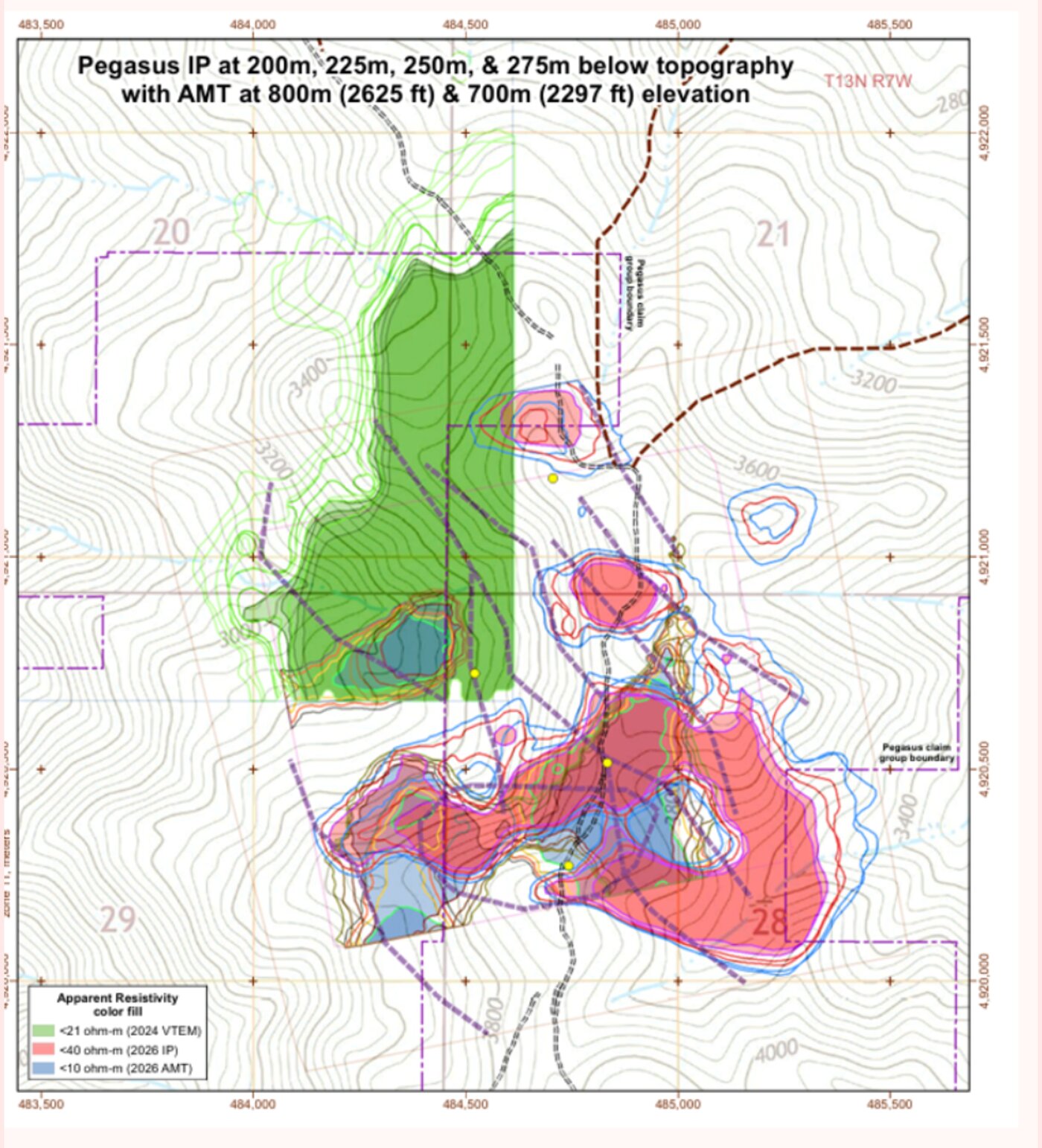
We ran Terravision over a highly prospective claim in Idaho with existing 3D geophysics. Despite the ground being partially covered by a recent wildfire, our engine isolated a distinct alteration halo directly adjacent to the deep <40 ohm‑m conductive target.
The result: clean, ranked drill pads ready to be actioned for the next campaign.
Pricing
Tier 01
Tier 02
FAQ
No. We complement it. Terravision gives you the surface alteration "leak" layer to confirm and prioritize your existing deep geophysical targets.
48 hours from when you provide the bounding box. Large multi-parcel deals are processed in priority order within 24 hours.
Perfect. Send it over. Our engine will instantly pick up the exact coordinates you want surveyed.
Just a bounding box or KML file. We handle everything else.
Send us your claim bounds. We'll do the rest.