Terravision / Services / Mine water & legacy mining

Mine water & legacy mining

Which mine-water heat sites can actually be built?

Flooded coal workings hold low-carbon heat under many former mining towns. Whether a scheme gets built depends on what sits around the resource: sound ground, heat demand, grid capacity and access. We screen candidate sites against all four and return a ranked list.

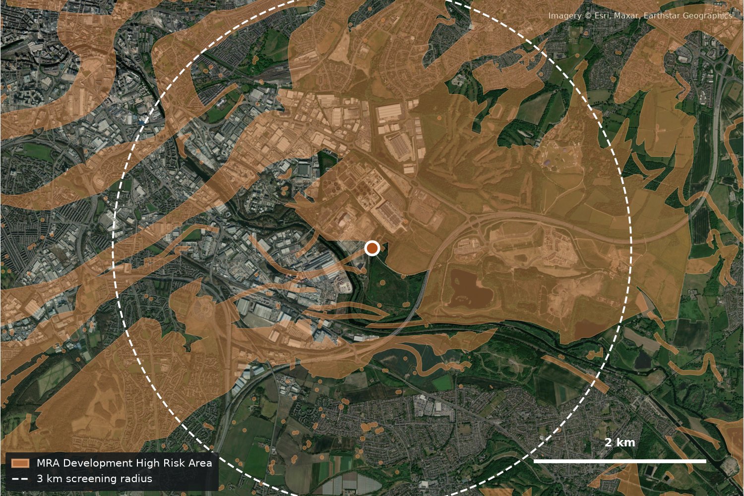
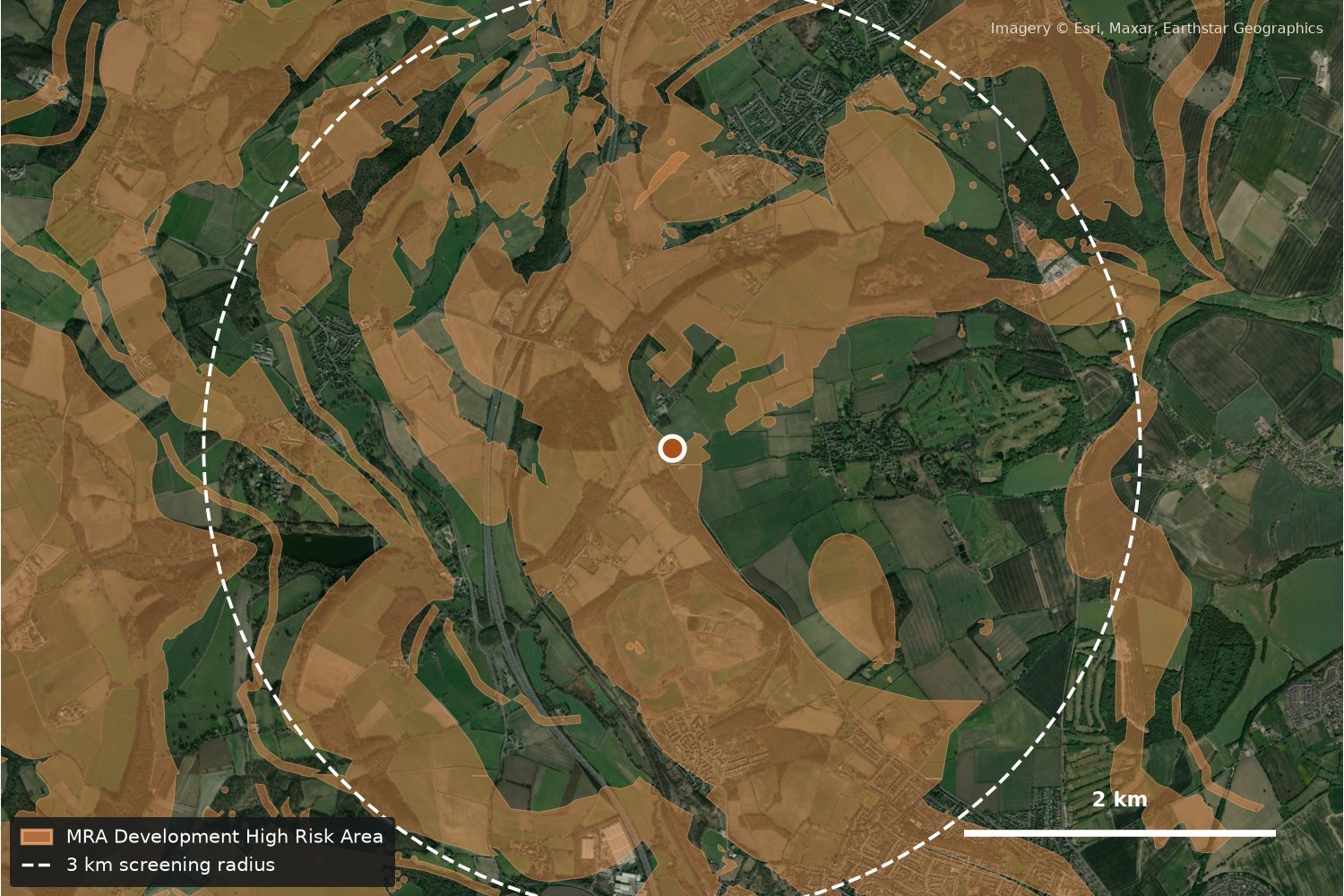
Skelton Grange, south-east Leeds. Shaded: MRA Development High Risk Area. Imagery © Esri, Maxar, Earthstar Geographics

Gate firstPass · Refer · Fail
Then rank onDemand, grid, access
DeliveryAbout 6 weeks
Siting studyFrom $2,300 intro
01Siting service

A buildability screen, with ground integrity as the first gate.

Most mine-water heat studies start with the resource. We start with the question that stops schemes late: is the ground sound enough to build the plant, boreholes and pipe routes? No point building on bad foundations. Only sites that pass, or pass with conditions, are scored on the rest.

  1. Ground and mine integrity gate

    Recorded mine entries, shallow and probable shallow workings, coal-mining high-risk areas, recorded subsidence and hazard reports, existing ground-movement data where it is available, and public geohazard data.

    • PassNo recorded shallow mining risk at the plant, borehole and pipe locations.
    • ReferRisk recorded. The site is still ranked, but needs a coal-mining risk assessment or ground investigation first.
    • FailUnsafe or unresolved. Removed from the ranking.
  2. Heat demand

    Homes, public buildings, estates and industrial users within piping distance, heat-network zoning where it exists, and anchor customers such as data centres.

  3. Grid headroom

    Published demand headroom and constraints at the local primary substation and upstream, because large heat pumps need electrical capacity.

  4. Access, land and planning

    Brownfield and large landholdings, routes for pipes and boreholes, and planning constraints such as green belt, flood zones and designations.

The output is a ranked site list with the records behind every score, GIS layers and a short plain-English report. It is a screening tool: not a mine-water resource estimate, not a coal-mining risk assessment, and not a grid connection offer.

02Example screens

Six places to test it, screened from public data.

Each card is a quick desk screen using public data only, run in November 2026. They show the method, not a finished study: mine-entry counts, workings detail, land and planning are added in a full study, and site points are approximate.

Satellite close-up of Woolley with ground-risk areas and a 3 km screening radius

MRA mine-water treatment scheme

Woolley

Wakefield / Barnsley, West Yorkshire

Integrity gateRefer
Ground48% of radius in a high-risk area
GridWoolley primary: 14.7 MW demand headroom
Heat demandFull study

MRA pumped treatment scheme with published heat potential. Ground and grid both need a closer look before ranking.

Satellite close-up of Skelton Grange with ground-risk areas and a 3 km screening radius

Planned data centre, Aire Valley

Skelton Grange

South-east Leeds

Integrity gateRefer
Ground47% of radius in a high-risk area
GridSelby Road primary: 0.0 MW demand headroom
Heat demandPlanned data centre (anchor); Aire Valley heat network nearby

Planned data centre beside the Aire Valley heat network: strong anchor demand, but the local primary has no published demand headroom.

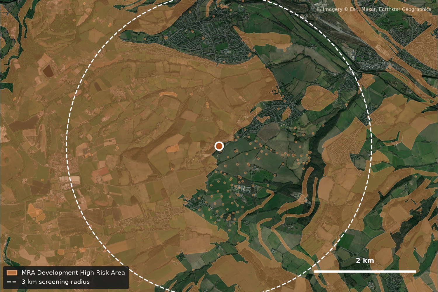
Satellite close-up of Caphouse with ground-risk areas and a 3 km screening radius

MRA mine-water treatment scheme

Caphouse

Overton, Wakefield

Integrity gateRefer
Ground52% of radius in a high-risk area
GridHorbury primary: 9.2 MW demand headroom
Heat demandFull study

Smaller MRA scheme on the edge of Wakefield, with green grid headroom. Ground is the main question.

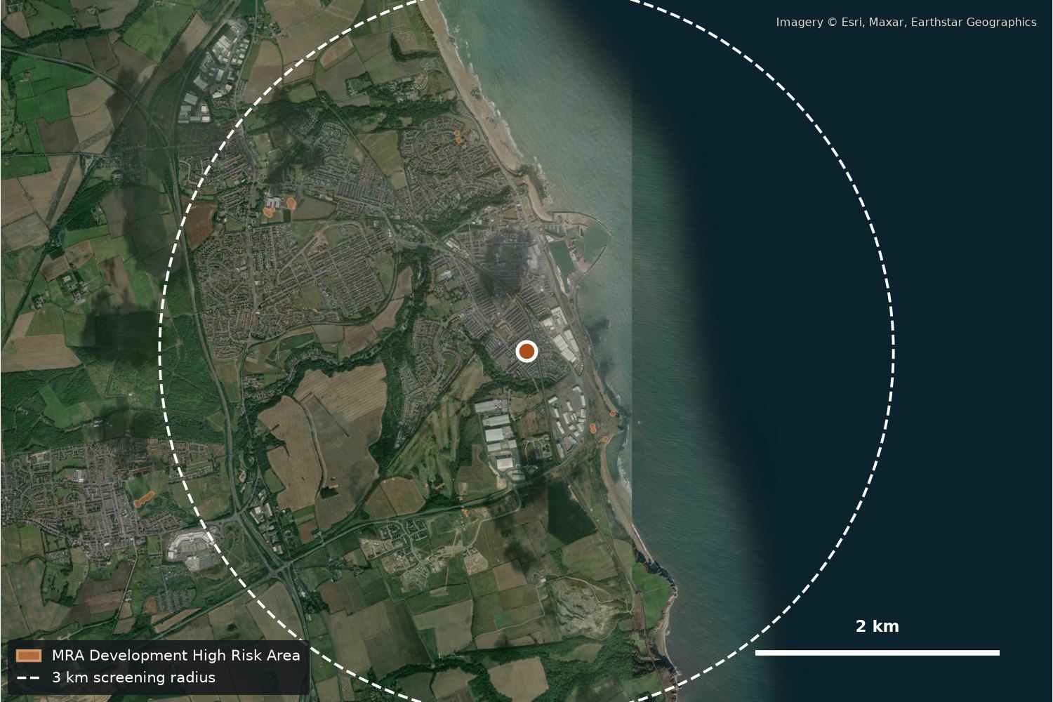
Satellite close-up of Seaham (Dawdon) with ground-risk areas and a 3 km screening radius

Durham coalfield town

Seaham (Dawdon)

County Durham, North East England

Integrity gatePass (provisional, high-risk layer only)
Ground0% of radius in a high-risk area
GridStoney Cut primary: 13.8 MW demand headroom
Heat demandFull study

Concealed coalfield: no Development High Risk Area within 3 km and green grid headroom, a useful contrast with the Yorkshire sites. Mine entries still need checking in a full study.

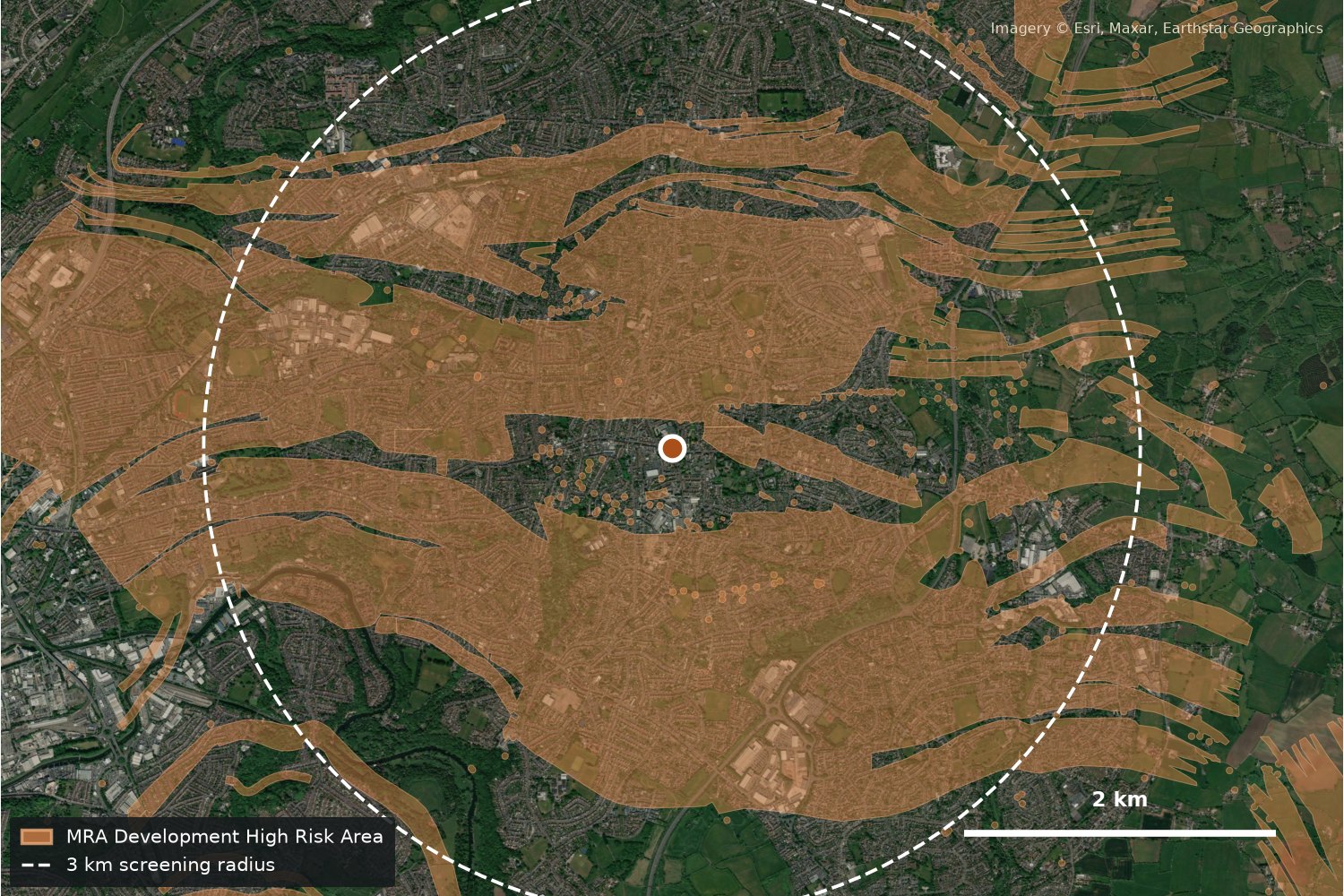
Satellite close-up of Kingswood with ground-risk areas and a 3 km screening radius

Bristol coalfield suburb

Kingswood

South Gloucestershire, West of England

Integrity gateRefer
Ground52% of radius in a high-risk area
GridWoodland Way primary (1.1 km away): 5.1 MW demand headroom
Heat demandDense suburban housing

Dense suburb over the Bristol coalfield with plenty of heat demand nearby, but half the screening radius sits in a high-risk area.

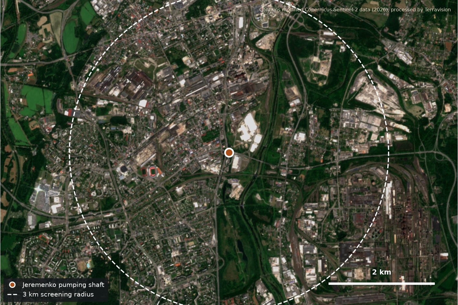
Sentinel-2 satellite view of Ostrava (Jeremenko) with the pumping shaft and a 3 km screening radius

State mine-water pumping shaft

Ostrava (Jeremenko)

Moravian-Silesian Region, Czechia

Integrity gateRefer
Ground82% of radius undermined; 19 recorded mine workings
GridPilot: no comparable public headroom data found
Heat demandCity heat network nearby (Veolia)

State pumping shaft discharging warm mine water. Public Czech data shows extensive undermining and recorded workings nearby.

Sources: Mining Remediation Authority Development High Risk Area (Open Government Licence); Northern Powergrid Open Data, substation heat map; National Grid Electricity Distribution LTDS capacity heatmap (South West); Czech Geological Survey (ČGS) data on undermined areas and mine workings, used for the Ostrava ground figures (map not reproduced); Imagery © Esri, Maxar, Earthstar Geographics; Ostrava image contains modified Copernicus Sentinel-2 data (2026). Retrieved 21 November 2026. Headroom figures are published indicative values, not connection offers.

03Legacy ground risk

Where old workings are likely to show at the surface.

Crown-hole and sinkhole screening

Crown holes form where shallow workings or old shafts collapse towards the surface. We combine recorded workings and mine entries with terrain, drainage and surface-change data to flag the places most worth inspecting first, for estates, roads, rail and development sites. It is a prioritisation layer for engineers, not a guarantee that a hole will or will not appear.

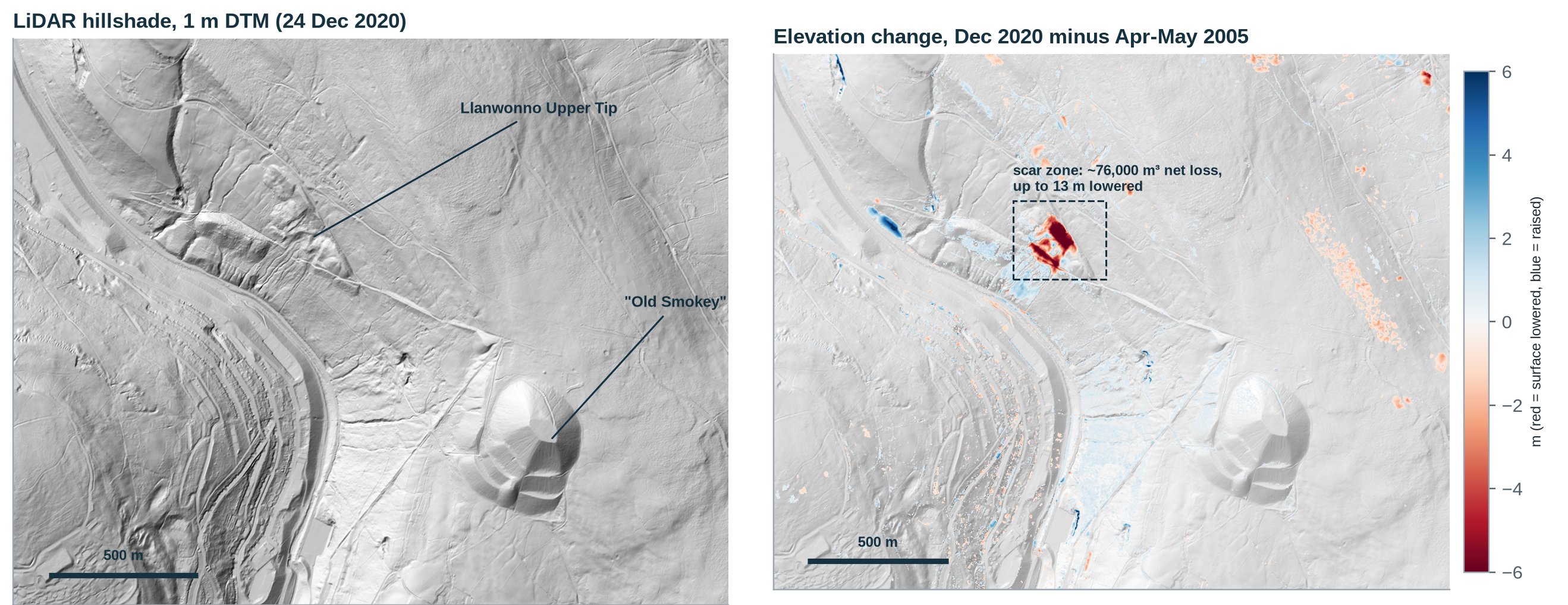
Spoil and coal tip monitoring Coming soon

Repeat aerial LiDAR, satellite imagery and thermal data can show where a tip surface has moved, lost vegetation or is warming. We are developing this as a recurring check for tip owners and councils.

LiDAR hillshade and elevation change at Llanwonno Upper Tip, Tylorstown, showing the 2020 slip scar
ExampleLlanwonno Upper Tip, Tylorstown (Rhondda Fach): 1 m LiDAR hillshade and elevation change between 2005 and 2020, showing the 2020 slip scar. Welsh Government LiDAR 2020–22 and NRW LiDAR archive 2005 (DataMapWales), Open Government Licence.
04Who it is for

For anyone deciding where to build over old mines.

Councils

A short list of mine-water heat sites worth funding feasibility for, and early warning on ground risk across estates and highways.

Heat-network developers

Which energy-centre and borehole locations clear the ground gate and have the grid and demand to make a scheme work.

Housebuilders

Ground integrity and low-carbon heat options screened together, before land is bought or a layout is fixed.

Data centres

Sites where mine water could help with cooling or take waste heat, cross-checked against grid headroom.

Insurers

A consistent legacy-mining screen across a portfolio of addresses or assets.

05Pricing

One study, one area, a ranked answer.

A siting study covers one area of interest, typically a town or a set of candidate sites, and takes about six weeks from an agreed boundary, with a midpoint review and a handover session.

You receive the integrity gate result and ranked site list with the records and scoring behind each site, GIS layers ready to load alongside your own data, and a short report with maps.

Prices in US dollars. The introductory rate applies to a first project.

Siting study$3,300$2,300
Delivery~6 weeks
Areas1 per study
Request a siting study

Tell us the area and what you want to build. We reply with a proposed boundary and what public data covers it.

06Questions
Does this replace a coal-mining risk assessment or site investigation?

No. The gate tells you where a coal-mining risk assessment or ground investigation is needed and where the records look clear. It does not replace either.

Do you estimate how much heat is in the mine water?

No. We use published mine-water and heat-potential data where it exists and focus on whether the surrounding site is buildable.

Does it work outside the UK?

Yes, where public mining, grid and demand data exist. The Ostrava example uses Czech Geological Survey records; coverage varies by country and we say where it is thin.

What data do you need from us?

Only a boundary or a list of candidate sites. If you hold your own records, such as borehole logs or demand data, we can include them.

Tell us about your area.

A rough boundary is enough to start. We reply to every enquiry, usually the same day.

We use your details only to reply to this enquiry. Prefer email? chris@terravision.solutions.