
Terravision / Services / Mining
Satellite mapping for mineral exploration.
A short list of ground worth walking, built from NASA EMIT hyperspectral, ASTER and Sentinel-2 imagery, with fault and lineament mapping from high-resolution terrain data. Delivery is within 48 hours of a confirmed boundary.
Mapped surface alteration and structure, not drill targets and not a resource estimate.
What we deliver
For a project area you name, we map the alteration minerals the sensors can see, add structure from terrain, and return ranked zones with a plain written note: what the data shows, where it is weak, and what it cannot tell you. You receive a Google Earth KMZ, GeoTIFF rasters, a CSV of coordinates and scores, and the summary. The same method is used on our ready-made map packs if you want to judge the work on a known district first.
Prices and turnaround
A 4 km² small test is $950, credited against a full order within 30 days if you continue. A starter area up to 100 km² is $3,300, or $2,300 for a new client's first project. Larger or multi-parcel programmes are priced on enquiry. Delivery is within 48 hours of the boundary being confirmed. All prices are in US dollars. If an area is not workable we will tell you before starting and refund you in full.
Questions we are asked
What minerals can you actually map?
Clays, sulphates and iron oxides that have a distinct spectral signature at the surface: kaolinite, alunite, muscovite or illite, jarosite, hematite, goethite and related groups, depending on the sensor and the ground. We cannot see metals at depth, or alteration hidden under cover.
Will this tell us where to drill?
No. It is a way of deciding where to spend field days. A strong clay anomaly is not a drill target, and plenty of altered ground is barren.
How do you handle claims and land status?
Where public claim and land-status data exist, we can include them so you can see which altered ground appears open. That is a desktop check, not a title search. Verify on the official register before you spend money staking or drilling.
Can we see a worked example first?
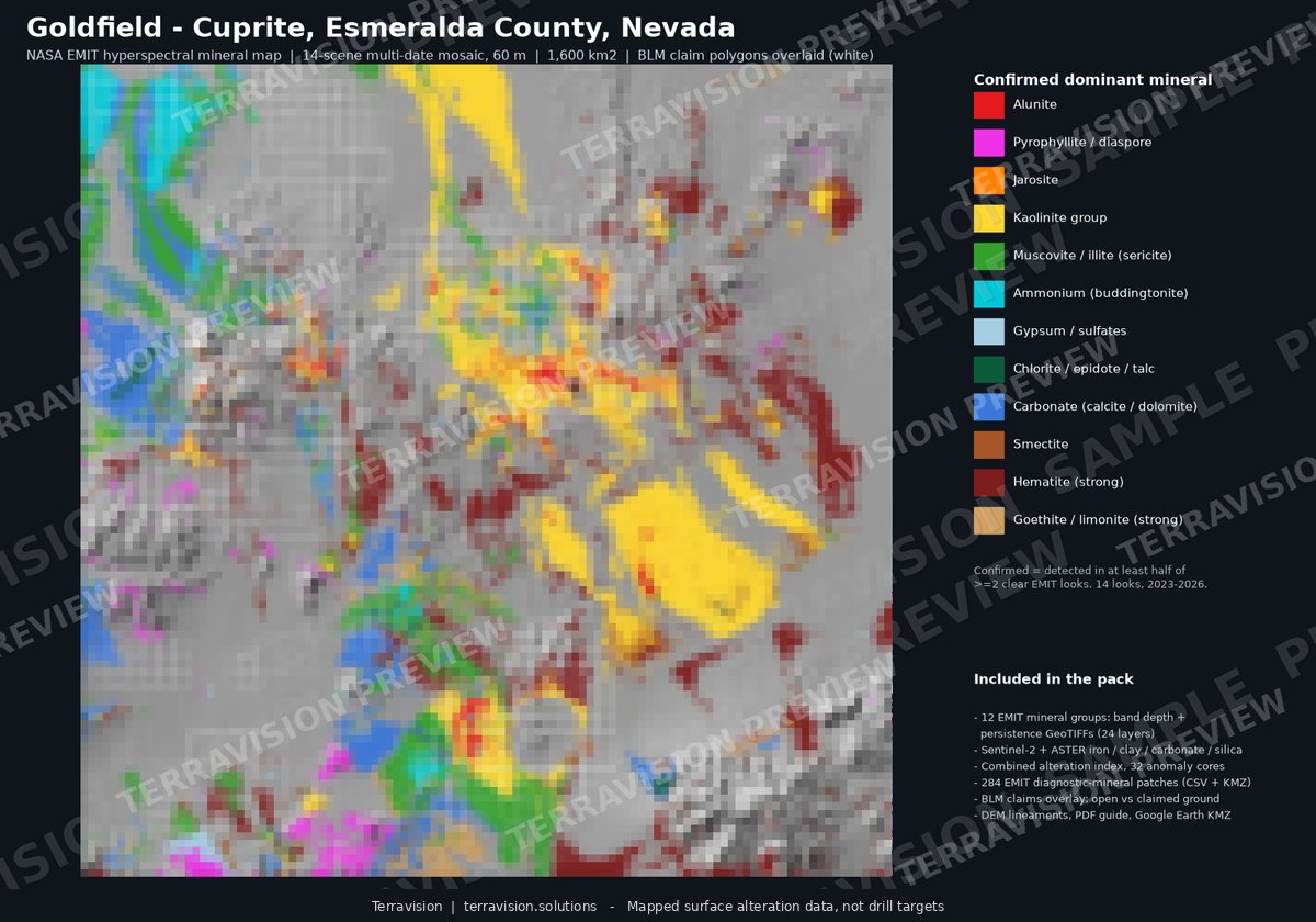
Yes. The Goldfield–Cuprite map pack is a finished, documented set of layers for a well-known Nevada district, and there is an honest write-up of a held-out check on that ground.
Tell us about your ground.
A rough location is enough to start. We reply to every enquiry, usually the same day.