
Terravision / Map packs / Goldfield–Cuprite
Goldfield–Cuprite EMIT mineral map, Nevada
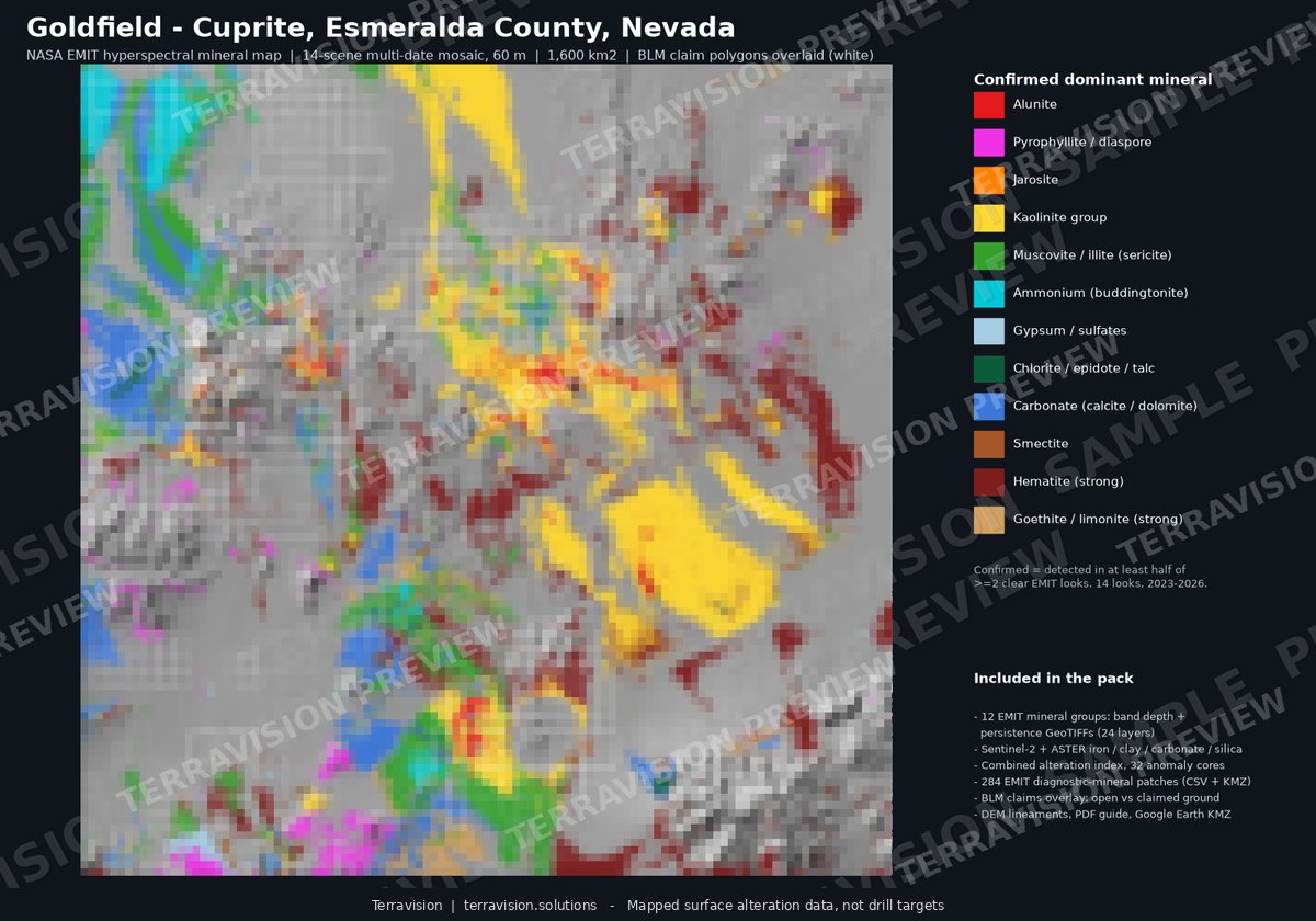
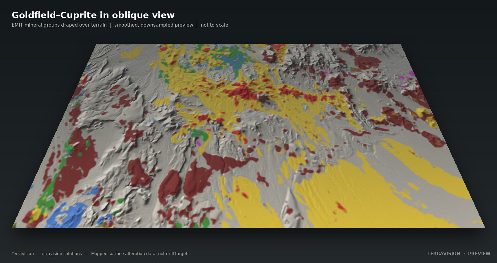
An EMIT alteration map pack for one of the best-exposed alteration districts on Earth: dry, bare ground, and the reference site for hyperspectral remote sensing. It gives you documented, GIS-ready layers so you can screen the district in minutes rather than days.
Surface alteration layers, not drill targets.
Buy the pack (checkout on Payhip) →
Instant download, about 150 MB. Prices in US dollars. Team and academic licences are options at checkout.
Questions first? Get in touch.
What's in the pack.
| Area and resolution | About 1,600 km². EMIT layers at 60 m; Sentinel-2 and ASTER indices at 20 m. WGS84 and UTM zone 11N. |
|---|---|
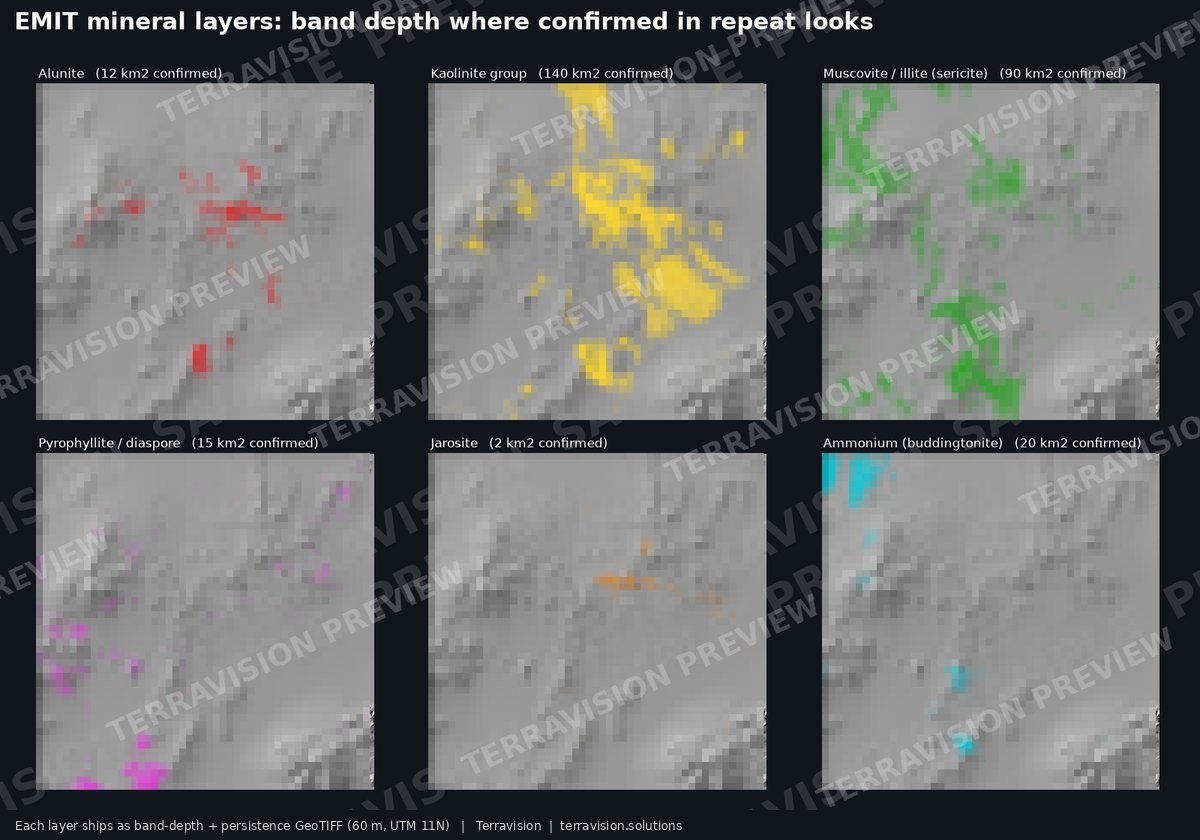
| EMIT minerals | 12 groups: alunite, kaolinite, muscovite/illite (sericite), pyrophyllite/diaspore, smectite, ammonium (buddingtonite), jarosite, goethite/limonite, hematite, carbonate, chlorite/epidote/talc and gypsum. Each has band depth, persistence (how many looks agree) and a confirmed flag. |
| Repeatability check | A split-half agreement test shows which layers to trust (kaolinite, ammonium, hematite, pyrophyllite) and which are indicative only (jarosite, smectite). |
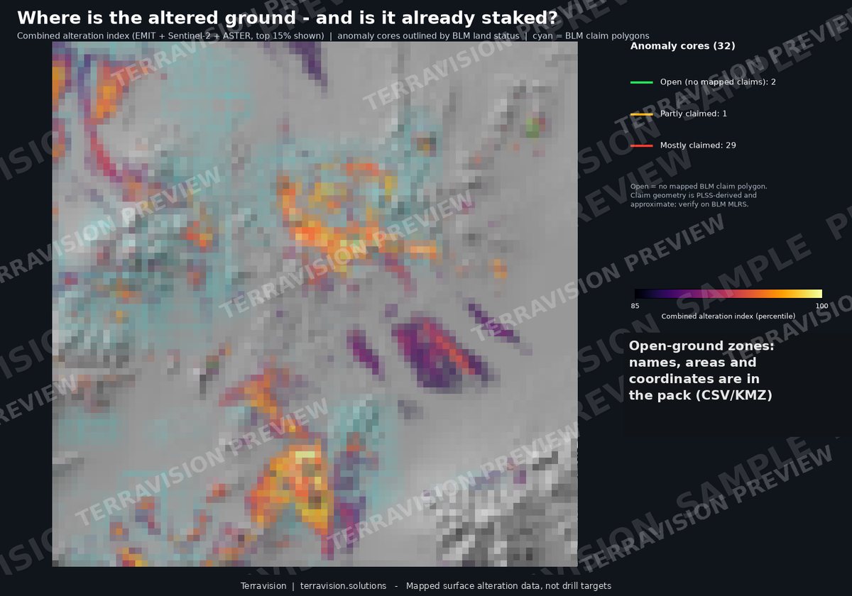
| Combined index | A combined alteration index with 32 anomaly cores, 33 footprints and 284 EMIT mineral patches, all with coordinates. |
| Structure | DEM lineaments classified against mapped faults, fault intersections and fault-density rasters. |
| Claims | BLM mining-claim overlay showing which alteration is claimed and which sits on open ground. The best of it is already staked. |
| Known mines and prospects | 460 USGS MRDS records with commodity and status, plus 3,236 workings from USGS topographic maps. |
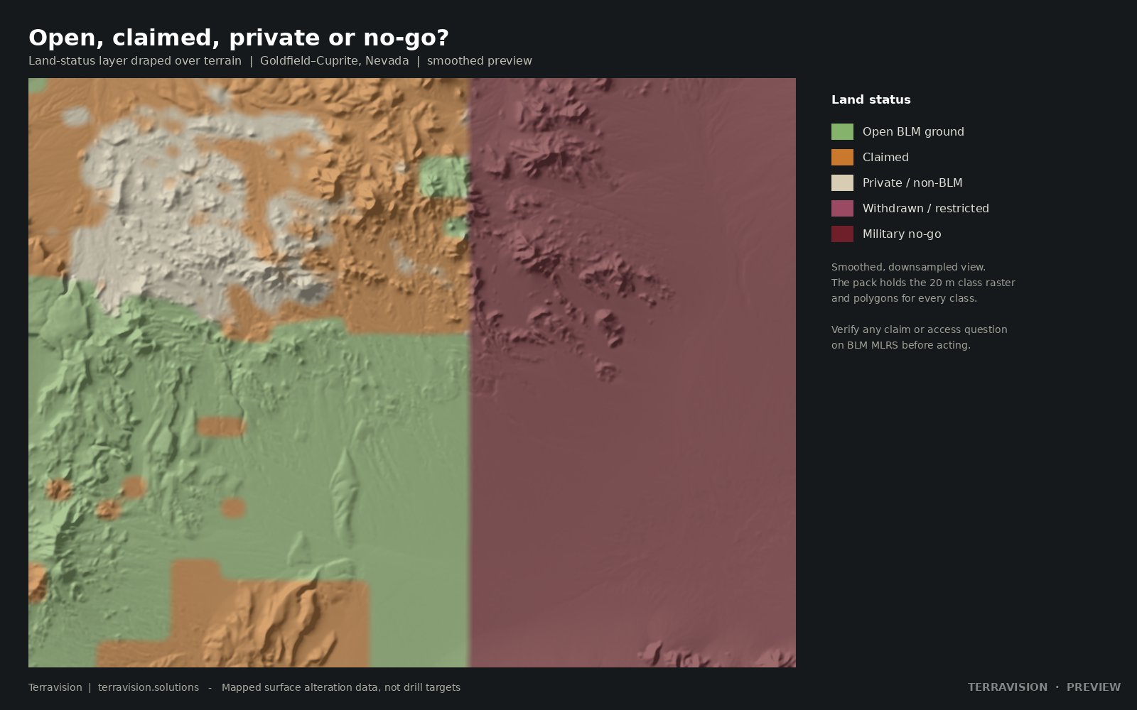
| Land status | Open BLM, claimed, private, withdrawn and military no-go land, including 394 km² of the Nevada Test and Training Range. Each known-deposit point is tagged with the land status where it sits. |
| Formats | 46 GeoTIFF layers; GeoPackage and GeoJSON vectors; CSV tables with lon/lat and UTM; three Google Earth KMZ files; a 10-page PDF guide covering method, GIS use, limits, data credits and licences. |
| Licence | Single-user licence for your own internal and commercial use. No resale or redistribution. The team licence covers up to five users. Third-party data is credited in the guide. |
Before you buy.
Can I use this to choose drill holes?
No. These are mapped surface alteration layers. They show where certain minerals are at the surface and which ground is open or claimed. They don't show what's underneath, and they aren't a resource estimate. Use them to decide where to go and look.
Why Goldfield and Cuprite?
The ground is dry and mostly bare, so satellites see the rock rather than plants. That's why Cuprite became the reference site for hyperspectral work, and it makes a fair test of what EMIT can do.
Which layers should I trust most?
The guide includes an agreement check between independent halves of the data. Kaolinite, ammonium, hematite and pyrophyllite repeat well. Jarosite and smectite are indicative only, and we say so.
Are the claim boundaries exact?
No. The claim polygons are a snapshot derived from the PLSS and are approximate. Verify any claim or open-ground question on the BLM MLRS before acting on it.
What software do I need?
Any GIS that reads GeoTIFF and GeoPackage: QGIS, ArcGIS and so on. The three KMZ files open in Google Earth, and the PDF guide explains how to load everything.
Can I get a refund?
It's an instant digital download, so sales are final once downloaded. If a file is faulty or won't open, get in touch and we'll fix it or refund you.
Can you map a different area?
Yes, that's the custom service: a small test from $950, or a starter area up to 100 km² for $3,300. See the options. Packs for other districts are also available.
Other districts: all map packs. Further reading: EMIT vs ASTER vs Sentinel-2 for alteration mapping