Terravision / Services / Environmental
Water, vegetation, air context and dam screening in one site report.
Specialist firms already offer dedicated tools for water quality, methane, oil spills or tailings InSAR. Terravision puts the layers that matter at one industrial site into a single, readable report, at a price and turnaround that work for an initial look as well as for smaller operators.
These maps are not laboratory results and not a permit or GISTM conformance document. They do not replace on-site sampling or an engineer-of-record monitoring plan.
What the report can include
For a typical mine, oil and gas, waste or other industrial site:
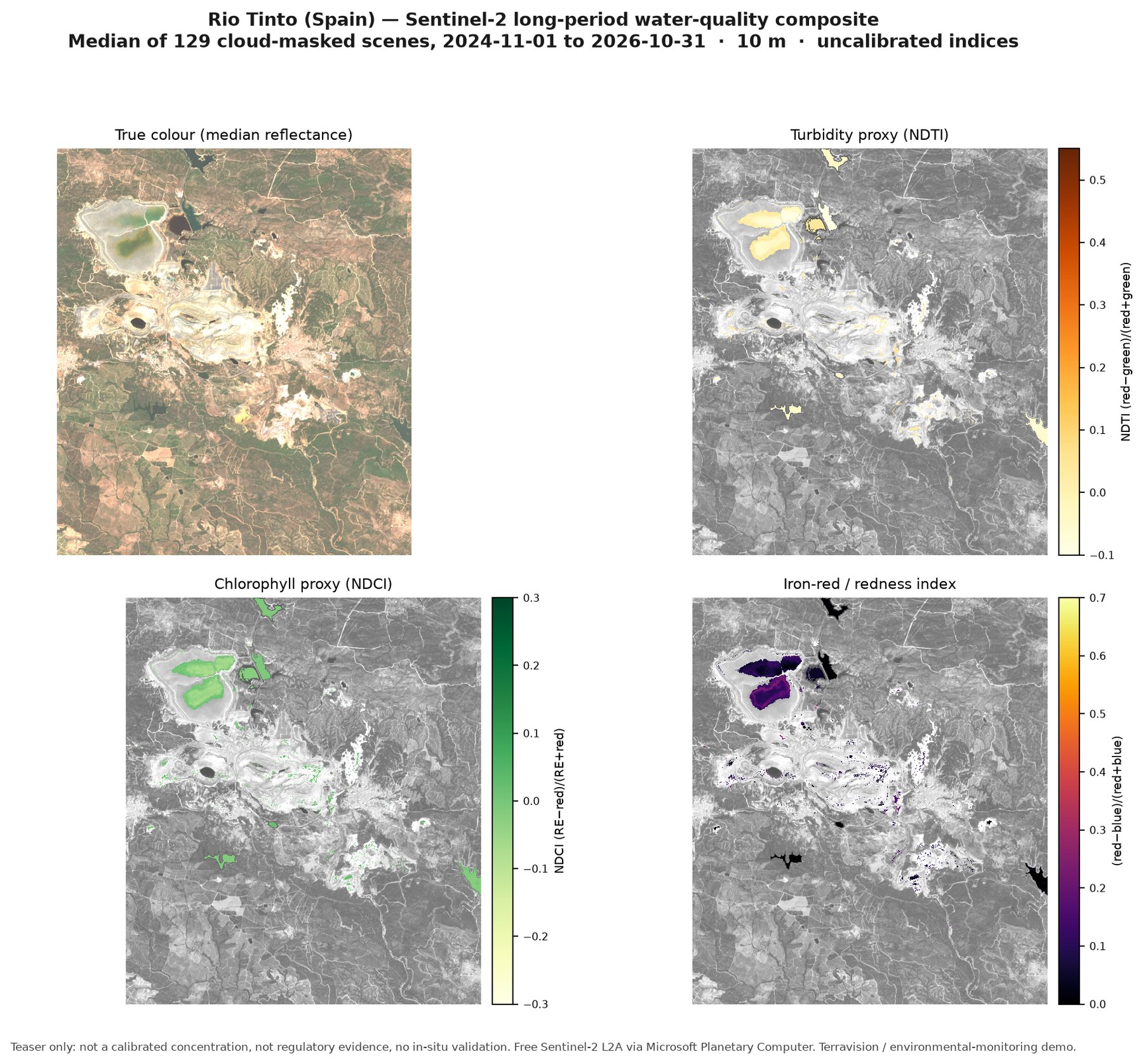
- Water colour and quality indicators (turbidity, a chlorophyll/algae proxy, iron-red or mine-water staining) from long-period Sentinel-2 composites, not a single scene
- Vegetation stress around ponds, tips, drains and well pads
- Sentinel-1 screening for pond extent, possible sheens and, where the ground is suitable, dam or surface movement
- Public air and methane context (Sentinel-5P, EMIT) where it is useful, with the limits stated
- Hyperspectral context from open missions where coverage exists
You receive a short plain-English note, annotated maps, and a methods section that states the period, the sensors and what was not seen.
Prices
All prices are in US dollars. Introductory prices apply to a new client's first project, booked by 31 March 2027. Commercial very-high-resolution imagery or taskable methane data, if a site needs them, are quoted as a client-paid add-on.
What it is not
InSAR is not a real-time alarm and will not catch every failure mode (piping, overtopping, or a rapid brittle failure). Sentinel-5P is too coarse for facility-level leak findings. A narrow UK discharge may be only a pixel or two at 10 m, and sometimes smaller than that. We will say so if a site is a poor fit before we start.
Questions we are asked
Can this replace water sampling or a lab result?
No. The maps are uncalibrated indicators from satellite colour and related indices. They help you see change and decide where field time is worth spending. They are not a dissolved-metals, pH or chlorophyll-a certificate.
Does a movement screen mean a tailings dam is safe?
No. A Sentinel-1 or EGMS screen can show slow surface movement where the radar returns are usable. It is not a real-time alarm, and it does not replace piezometers, inspections or an engineer-of-record plan. High-resolution commercial radar, if a high-consequence facility needs it, is a client-paid add-on.
Can you find a methane leak at a single well or landfill cell?
Public Sentinel-5P data is useful for large industrial complexes and regional plumes, not for facility-level leak findings. EMIT can show large plumes where a scene exists. If a site needs taskable, facility-scale methane data, we will say so and quote it as an add-on rather than over-claim what the public sensors can do.
Who is this for?
Mine operators (including juniors), oil and gas operators, landfill and industrial sites, consultants preparing a site pack, and agencies or investors who want an independent wide-area picture. A related, narrower product — EMIT mapping of iron-oxide and acid-drainage minerals around mine waste — is described under mine-waste and environmental mapping.
Tell us about your area.
A rough boundary is enough to start. We reply to every enquiry, usually the same day.