
21 November 2026 · Terravision · In-house demonstration
The same class of spectral methods, from Mars to Earth
This is an in-house demonstration, not a client project and not a NASA project. Terravision composited a public CRISM observation of Jezero crater, Mars, to show the family of spectral-parameter methods behind its Earth mapping.
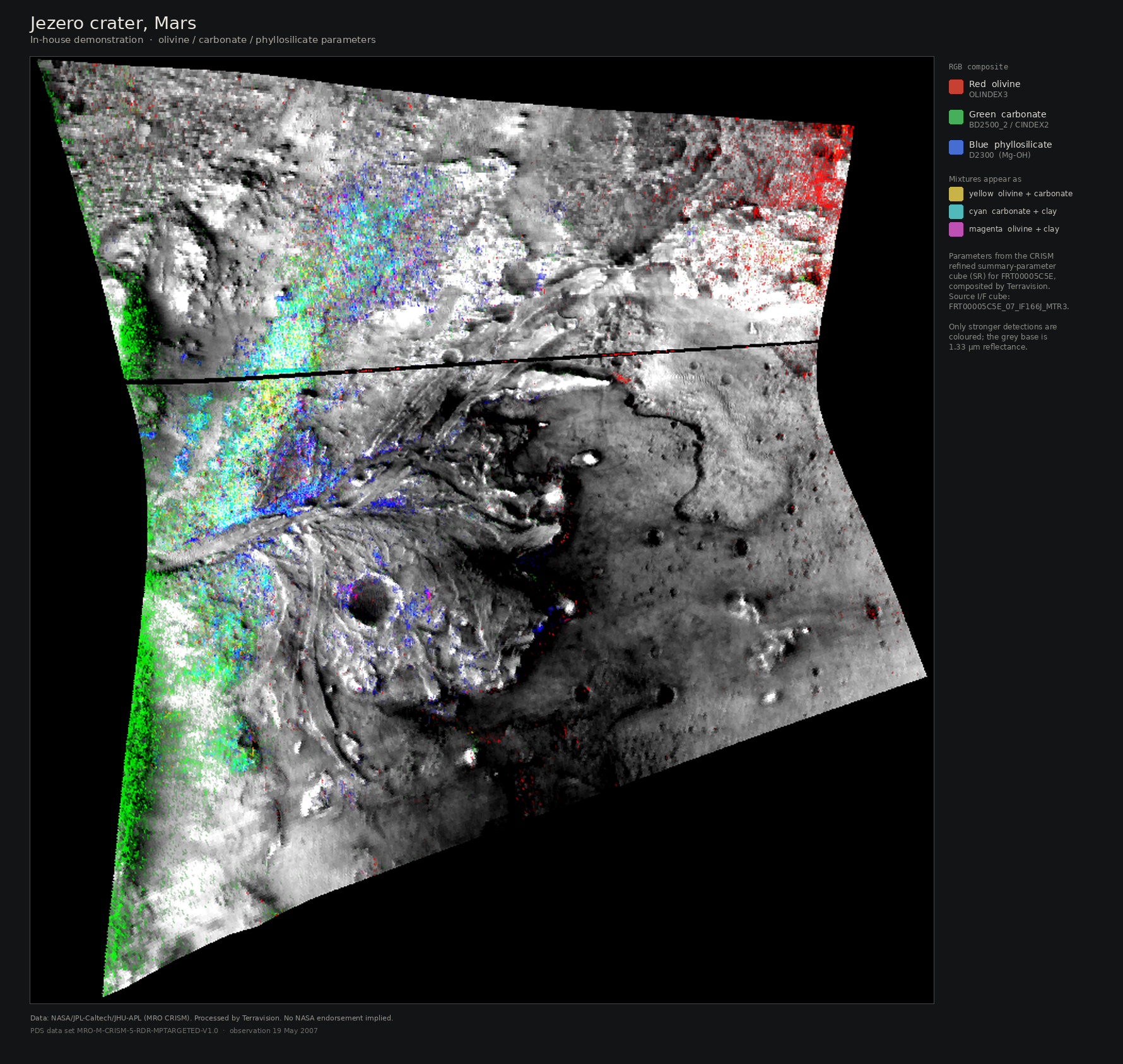
The Compact Reconnaissance Imaging Spectrometer for Mars, or CRISM, records a surface at hundreds of wavelengths, in the same broad family as NASA EMIT, EnMAP and PRISMA on Earth. Planetary scientists turn those spectra into simple parameter maps: a band depth here for clay, another for carbonate, an index for olivine. The colours are a way of seeing which absorption is strongest, not a claim that a deposit has been found.
Terravision uses the same class of spectral methods used to map minerals on Mars, applied to Earth sensors (ASTER, Sentinel-2, EnMAP, PRISMA). The Jezero map above is a demonstration of that family of methods, built in-house from a public NASA Planetary Data System archive (data set MRO-M-CRISM-5-RDR-MPTARGETED-V1.0, product FRT00005C5E_07_IF166J_MTR3 and its refined parameter cube). It is not a commission, not a forecast, and not a mineral-resource result.
A parameter map of this kind is a surface indicator. It does not see through dust, soil or cover, and it does not pick a drill hole. On Earth the useful next step is the same as on a well-studied district: sit the alteration against land status and structure, then walk the ground. For how Terravision reads those maps in practice, see How to read a satellite alteration map and EMIT versus ASTER versus Sentinel-2.
In-house demonstration from public NASA data. Mapped surface mineral parameters, not drill targets.