
19 November 2026 · Terravision · 7 min read
Lithium clays from orbit: what EMIT can and can’t see at Clayton Valley
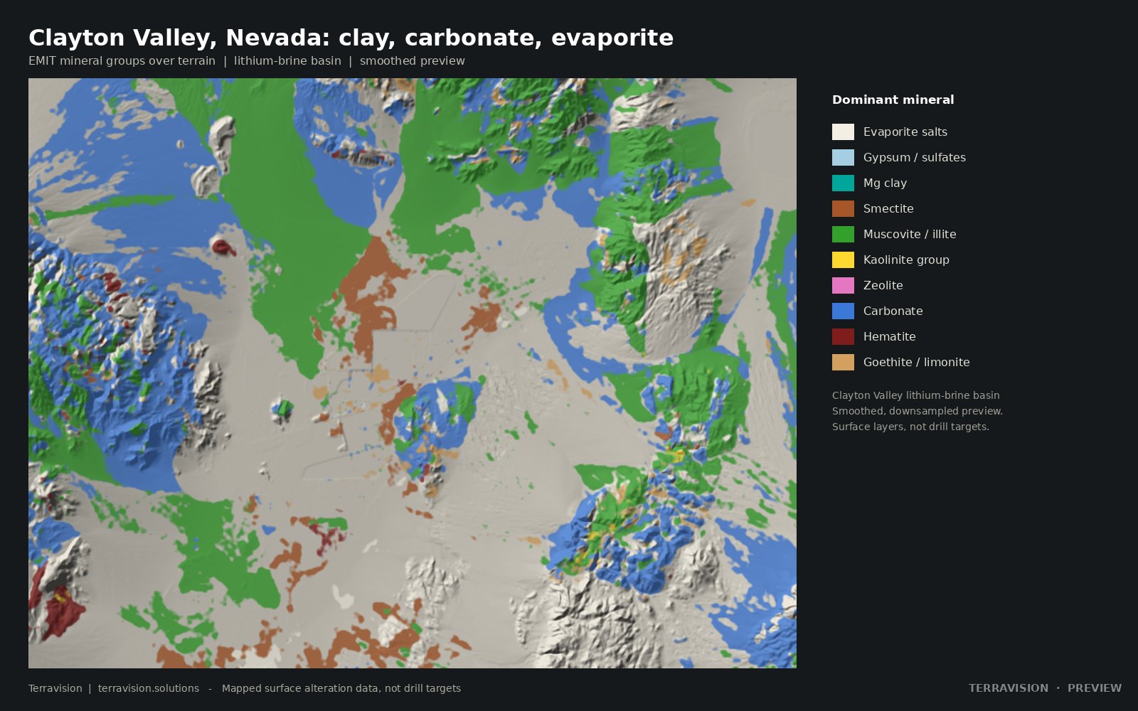
Clayton Valley, in Esmeralda County, Nevada, is one of the few places in the United States with a long-running lithium-brine operation, at Silver Peak, and it is also a focus for lithium-bearing clays in the basin sediments. It is a natural district to ask what a satellite mineral map can actually add. The short answer is: quite a lot about the surface, and nothing about the brine itself.
What EMIT is looking at
NASA's EMIT instrument records a dense spectrum for each 60 m pixel, which is enough to pick out individual clay and evaporite minerals at the surface. In a basin such as Clayton Valley that means smectite and magnesium-rich clays, kaolinite, illite or muscovite, carbonates, gypsum and other evaporite salts, and iron oxides. Those are the materials you can see on playas, clay flats, fans and the hills around the basin, if they are exposed.
A finished set of those layers, with claims, a playa outline, recorded mines and a land-status map, is in the Clayton Valley map pack. The previews on that page are watermarked and downsampled; the pack carries the full rasters. Custom screening of another basin, using the same idea, is described under lithium brine and clay screening.
What it cannot see
Lithium in brine sits in groundwater, in sediments, at depth. EMIT cannot see it. There is no absorption feature in the shortwave infrared that lets a satellite read dissolved lithium through alluvium and a playa crust. A strong clay or evaporite pixel is not a grade, and it is not a well. Anyone who tells you they have mapped a lithium resource from orbit is over-claiming.
Even at the surface, clay is not the same thing as a lithium-bearing clay. Smectite and related minerals are common. Some of them host lithium in certain basins; many do not, or not in an amount that matters. EMIT can tell you that a clay is present and, often, which group it belongs to. It cannot tell you the lithium content. That takes sampling and a laboratory.
How to use a basin map without fooling yourself
The useful questions are geographic. Where are the clay-rich and evaporite-rich surfaces? Where are the carbonates? Where is that pattern already claimed, or sitting on land that is not open to work? Where is the playa, and where does the alteration or the clay signal sit on the margins and the fans? Those are screening questions. They can save a lot of driving, and they can stop you spending time on ground you cannot stake.
They do not replace hydrology, subsurface data or a resource model. A closed basin can have a rich brine under a dull surface, and a colourful clay flat can be barren. Cover works the same way as it does for gold or copper alteration: alluvium and crusts hide what is underneath. At 60 m, a narrow target is easily mixed with its neighbours. Repeat looks help, because a mineral that persists across dates is more believable than a one-scene splash, but persistence is still not chemistry.
Claims and land status, again
Clayton Valley is a busy place in the public record. A mineral map that does not carry claims and land status is only half a screen. The pack includes a BLM claim overlay and a land-status layer so you can see, at preview resolution, which of the clay and evaporite patterns sit on ground that already looks taken, and which do not. As with any Nevada project, that overlay is a snapshot, not a title search. Check MLRS before you act. There is a longer note on finding open ground in Nevada.
Where this leaves you
If you already work the basin, a satellite clay and evaporite map is a way of seeing the surface pattern consistently, at one date or across a few clear looks, and of sitting that pattern against tenure. If you are new to the area, it is a way of deciding which parts of a large basin are worth a first field day. In both cases the work stops at the surface. The brine, the grade and the economic case have to come from the ground and the lab, not from the satellite.
Surface mineral layers, not a lithium resource. The Clayton Valley pack is a documented example, not a promise about any other basin.