
19 November 2026 · Terravision · 7 min read
Finding open ground in Nevada: claims, BLM land status and what satellite data adds
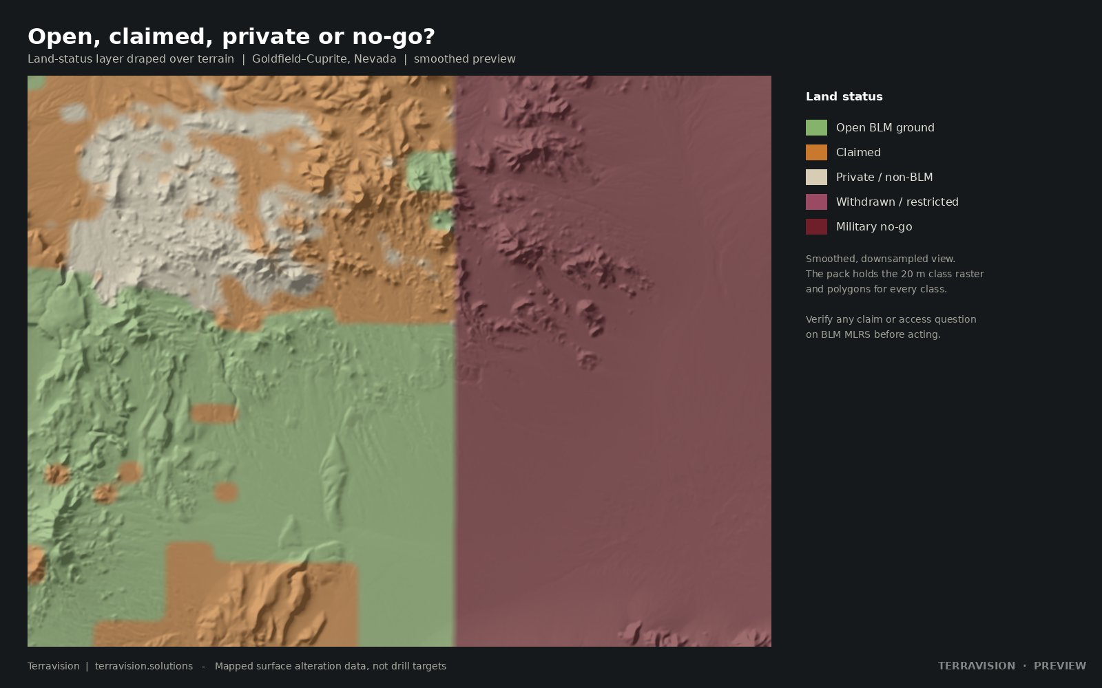
A lot of mineral exploration in Nevada starts with a simple question: is this ground open, and is there any reason to walk it? Public claim and land-status records answer the first part, imperfectly. Satellite alteration maps can help with the second. Neither is a substitute for a current title check, and both are easy to over-read. This note sets out how we use them together.
What “open ground” usually means
Much of Nevada is federal land managed by the Bureau of Land Management. Under the General Mining Law, a US citizen or a US company can locate an unpatented mining claim on land that is open to mineral entry. Land that is withdrawn, reserved as wilderness or a wilderness study area, or set aside for the military, is not. Private land, state trust land and split-estate minerals sit under different rules. Only a US citizen or US company can locate a federal claim; a company based elsewhere can still look at the data, but staking has to go through someone who is eligible.
The official place to check mining claims on federal land is the BLM's Mineral Land Records System, MLRS. Claim polygons you see on a web map, including ours, are a snapshot. They can lag filings, miss a claim that is not in the layer we used, or simplify a boundary. They are a way of seeing the pattern, not a title search, and they are not enough to spend money on.
What else sits on the land-status map
A useful land-status layer is more than “claimed or not”. It should also show withdrawals, wilderness and wilderness study areas, and, where the records exist, notices and plans of operations. In Nevada that often includes large military reservations and other no-go land. A bright alteration patch that sits inside a withdrawal is interesting geology and a poor place to plan a staking programme.
Even on BLM land that looks open, there can be constraints the mineral layer will not show: habitat designations, cultural sites, access, and surface-use limits. We do not pretend to have screened all of those. A desktop product can tell you that the public claim layer was empty on a given date, and that the land is not an obvious withdrawal. The diligence after that is yours.
What satellite data adds
Once you can see, roughly, which ground appears open, the next question is where on that ground there is any surface reason to go. Hydrothermal systems leave clays, sulphates and iron oxides at the surface, and those minerals can be mapped from NASA EMIT, with ASTER and Sentinel-2 in support. A screen that keeps only altered pixels on land that, on public data, is BLM-managed, unclaimed, not withdrawn, and well away from recorded mines, is a way of building a short list. That is the idea behind our unclaimed alteration targets.
It is also why the Nevada map packs carry claims and land status next to the mineral layers. You can sit a kaolinite zone against a claim block in a GIS in a few minutes, which is much cheaper than discovering the same fact after a drive. The Goldfield–Cuprite and Clayton Valley packs are finished examples of that pairing, and there is a note on how to read the alteration map itself.
Limits that are easy to skip
Alteration is not a deposit. Much of it is barren. Clay on a flat, soil-covered basin floor is often not hydrothermal. Recorded mines and prospects, from USGS MRDS and USMIN, are incomplete; old unrecorded workings can sit closer than the database suggests. A buffer of a few kilometres from a recorded occurrence is a filter, not a guarantee of virgin ground. And “open on the day we pulled the data” is not “open on the day you stake”. Claims can be filed in the gap. We say so on every target delivery, and Tier B of that product includes a refreshed check just before you stake, but you should still look at MLRS yourself.
We do not stake claims, hold claims or give legal advice. If you want a recurring watch on a district, rather than a one-off snapshot, we offer claim and tenure monitoring against US BLM data, as a desktop alert service, not as a title register.
A practical order of work
Start with the official land status and MLRS. Add a current alteration and structure map. Discard ground you cannot work. Walk what remains, and only then think about staking. Used in that order, the satellite layer earns its keep. Used as a substitute for the register, it will get you into trouble.
Desktop land-status checks are not a title search. Verify on BLM MLRS before you spend money staking.